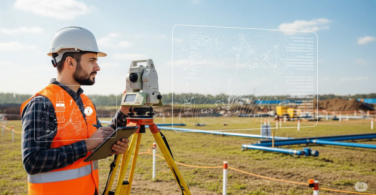
Surveying Technician: Career and Job Market
A poorly laid-out construction project can be costly, and the mistake almost always starts before the concrete is poured: with the land survey. That’s where a Surveying Technician comes in, turning field measurements into reliable information for engineering, construction, mining, and land regularization. In practice, this professional does more than just measure land. They interpret elevations, slopes, coordinates, adjoining properties, and boundaries with the level of precision an actual project requires. In this article, you’ll learn what this technician does, where they work, which tools they use, how the market tends to value the role, and what really matters for advancing in the field.

What You Need to Know
- Surveying is the technical foundation that reduces the risk of errors in construction, subdivisions, roads, dams, and mining.
- The work combines field and office tasks: collecting, checking, processing, and delivering georeferenced data.
- Equipment such as total stations, geodetic GNSS/GPS receivers, levels, and CAD/GIS software are part of the daily routine.
- Professionals who stand out in the field master precision, organization, plan reading, and communication with engineers and construction supervisors.
- The strongest job markets are in regions with urban growth, major infrastructure projects, and mining or agricultural activity.
What a Surveying Technician Does on a Construction Site
Technically speaking, a surveying technician conducts topographic and elevation surveys, establishes control points, checks alignments, and records actual site conditions to guide designs and construction. In other words, they turn terrain into usable data, with reliable coordinates, elevations, and reference points. Anyone who does this work knows that details matter. An alignment that’s off by just a few centimeters can compromise drainage, road grades, foundations, or roadway alignments. That’s why this professional needs to combine extreme attention to detail with a systematic checking method.
Key Responsibilities
- Surveying points on the ground with a total station, level, and GNSS receivers.
- Setting out construction projects, axes, building pads, contour lines, and control markers.
- Reading and interpreting plans, sketches, legal descriptions, and maps.
- Performing initial data processing for delivery to engineers, land surveyors, and designers.
- Checking for discrepancies between the plans and actual field conditions.
Where Precision Matters Most
Some fields allow very little margin for error: earthwork, paving, urban drainage, and mining. In these settings, even a small mistake can lead to rework, delays, and extra costs. The impact is also significant in subdivisions and land regularization, where boundary locations must match legal documents and records.
In practice, surveying works when clean field data makes it into the project. If measurements aren’t properly checked, errors carry through every subsequent stage.
Training, Technical Programs, and the Legal Framework
The most common route is to complete a technical program in surveying or a related field, such as land surveying, building construction, or geoprocessing, depending on the school and its curriculum. Training should combine applied math, technical drawing, plan interpretation, basic geodesy, and extensive hands-on fieldwork. One important distinction: surveying and land surveying are closely related, but they aren’t exactly the same in every professional context. In many contracts and companies, the technician performs operational measurement and support tasks; technical responsibility may depend on the project scope, credentials, and professional classification.
Common Topics in the Curriculum
- General and topographic surveying.
- Georeferencing and coordinates.
- Reading maps, plans, and profiles.
- Surveying instruments.
- Introduction to legislation, legal descriptions, and technical records.
For institutional references on training and education, consult the Brazilian government portal for regulations and professional information, as well as technical education resources such as the Federal Institute of São Paulo, which publishes programs and curricula in technology-related fields.
Tools, Equipment, and Software That Really Matter

Digital equipment has made fieldwork much faster, but the principles of precision remain the same. A total station measures angles and distances with high accuracy; geodetic GNSS/GPS supports positioning and control; and a level reliably transfers elevations.
Office work matters, too. Today, much of the value a technician delivers depends on organizing files and turning measurements into drawings and databases. Software such as AutoCAD, Civil 3D, QGIS, and post-processing platforms plays a major role at this stage.
Most Commonly Used Equipment
Tool
Main function
Where it makes the biggest difference
Total station
Measures angles and distances accurately
Setting out, surveying, and checking
Geodetic GNSS/GPS
Coordinate-based positioning
Georeferencing and control over large areas
Automatic or digital level
Measures elevation differences
Earthwork, drainage, and profiles
Tablet/data collector
Records field data
Productivity and traceability
Not every project requires the same set of tools. In compact urban areas, a total station is often the better choice; in large, open areas, GNSS has the advantage. In places with dense vegetation, tall buildings, or signal interference, choosing the right method matters more than the equipment itself.
The right equipment speeds up the work, but field checks and consistent referencing are what determine the quality of the results.
Read also: The Education Market: Current Trends and Opportunities
Job Market: Where Demand Is Highest and Why
This professional is most likely to find work in sectors where accurate physical implementation is essential. Common fields include construction, road infrastructure, land development, sanitation, mining, technical surveying, and precision agriculture.
According to data from the Brazilian Institute of Geography and Statistics (IBGE), urban growth and economic activity vary considerably across regions, directly affecting demand for surveys and construction layout. Hiring tends to be more consistent in areas with major construction and mining activity; in smaller markets, work volume fluctuates more and depends on specific projects.
Sectors That Hire the Most
- Construction companies and real estate developers.
- Earthwork and paving companies.
- Mining companies and mining service providers.
- Engineering and land surveying firms.
- Government agencies and infrastructure utilities.
I’ve seen technicians hired for a single project phase who went on to become permanent team members because they prevented layout errors. That happens when a company realizes the real savings aren’t in wages, but in the rework it avoids.
Read also: Sanitation Technician: A Complete Career Guide
One thing many people underestimate is that the field values professionals who can communicate with construction crews. Measuring accurately isn’t enough. You need to explain what you found, flag potential construction risks, and provide information that the site supervisor can use without ambiguity.Salary, Daily Work, and What Drives Professional Value
Pay varies widely depending on location, company size, level of responsibility, and digital skills. Professionals who handle demanding fieldwork, frequent travel, complex projects, or specialized shifts typically earn more than those limited to narrow support tasks.
In practice, three factors drive higher pay: autonomy, reliability, and technological expertise. A professional who knows how to use a total station and GNSS, read plans, and prepare reports moves beyond basic operational work and is seen as someone who can solve problems.
Reference data on wages and occupations is available from public sources such as Brazil’s Ministry of Labor and Employment and from education and workforce studies published by schools and research institutions. Figures vary by city and sector, so national averages should be treated with caution.
What Most Affects Pay
- Experience with more complex projects.
- The ability to operate and check equipment independently.
- Knowledge of CAD, GIS, and file management.
- Availability for fieldwork, travel, and tight deadlines.
- Strong plan-reading skills and communication with the construction team.
How to Stand Out in the Profession
The market quickly recognizes who simply goes through the motions and who delivers solutions. Technicians who advance tend to follow consistent checking routines, keep field notes organized, label points carefully, and record everything in a traceable way.
Spatial awareness is another advantage. Professionals who can visualize the terrain, rather than see it only as numbers, are better at interpreting slopes, elevations, cuts, and fills. That matters both on the job site and in the office.
Habits That Improve Performance
- Check readings before leaving the site.
- Standardize point names and file names.
- Store photos and sketches with the measurement data.
- Review the plans before setting out the project.
- Keep instruments calibrated and check them regularly.
A simple example: during the layout of a warehouse, the crew marked the axes correctly but ignored the lot’s natural slope. The result was drainage problems and the need to correct the subbase after the concrete had been poured. The problem wasn’t a lack of tools. It was a failure to understand the site as a whole.
What sets an average technician apart from a valued one isn’t just precise measuring—it’s understanding how each measurement affects construction.
When Surveying Connects with Georeferencing, Land Surveying, and Property Records
This is where the profession gets more specialized. In many projects, surveying goes beyond fieldwork and connects with georeferencing, multipurpose land records, property regularization, and mapping databases.
Not every job requires complex land records, and there’s an important distinction here: a standard construction survey may be relatively straightforward operationally, while georeferencing rural property requires stricter documentation and careful compliance with applicable rules. This method works well on standardized sites, but it can fail when boundaries are disputed, documents are incomplete, or boundary markers are missing.
For anyone looking to explore the intersection of spatial data and land, organizations such as INCRA, Brazil’s National Institute for Colonization and Agrarian Reform, provide guidance on standards and procedures for rural georeferencing. The IBGE Geosciences portal is a useful resource for understanding the mapping and territorial data used at different scales.
Fields Related to Surveying
- Land surveying.
- Geodesy.
- Geoprocessing.
- Land records.
- Civil and environmental engineering.
What to Do Next if You Want to Enter the Field
The best path is to combine technical training with hands-on field experience as early as possible. Training without job-site experience stays theoretical; job-site work without a technical foundation becomes guesswork. Combining the two is what builds a reliable professional.
If you want to get a head start, compare curricula, hands-on training hours, available instruments, and internship opportunities. Then check whether the program teaches plan reading, data processing, and field skills that are actually in demand.
CTA: Look for a technical program focused on hands-on learning, check its lab and field facilities, and compare the curriculum with real construction demands before enrolling.
Frequently Asked Questions
What’s the Difference Between a Surveying Technician and a Surveyor?
In the job market, the terms are often used interchangeably, but the role can vary depending on the company, training, and level of technical responsibility required. Technicians typically handle surveys, construction layout, and operational support, while signing off on work and assuming formal responsibility may require specific credentials.
Do You Need a College Degree to Work in the Field?
Not necessarily. Many positions are open to people with technical training, provided they know how to use instruments, read plans, and handle fieldwork. A college degree can expand your opportunities, but it isn’t the only way into the field.
Which Subjects Are Most Important in Training?
Applied math, technical drawing, surveying, geodesy, plan interpretation, and instrumentation are the most important subjects. Without that foundation, professionals may be able to operate equipment but lack confidence in analyzing the data.
Which Areas Pay the Most?
Large-scale construction, mining, road infrastructure, and specialized georeferencing services tend to pay more. Field experience and the ability to work with technology also make a significant difference.
Is This a Career with a Future?
Yes. Every construction project needs reliable measurements to move forward safely. Professionals who master digital tools, CAD/GIS integration, and land analysis are likely to find even more opportunities.
What Mistakes Most Often Hold Beginners Back?
The most common mistakes are relying too heavily on a single measurement, failing to review the plans before heading into the field, and keeping data disorganized. These may seem minor, but they lead to rework and undermine the team’s confidence.
Artigos Relacionados
 Complete Guide to Becoming a Laboratory Technician: Career, Training, and Job Market
 Naval Engineer: A Complete Guide to the Career and Job Market
 Nursing Technician: The Complete Guide to a Successful Career
 In-Demand Careers: How Artificial Intelligence Is Transforming the Job Market
 Mining Engineer: A Complete Guide to the Career, Education, and Job Market
 Systems Engineer: A Complete Career and Job Market Guide